
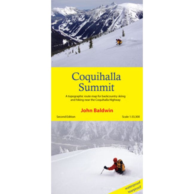
Coquihalla Summit Map

In Stock
A topographic route map for backcountry skiing and hiking from the Coquihalla Highway in southwestern BC Read more..
In Stock: 4-10 Business Days.
Coquihalla Summit describes backcountry skiing and hiking routes to alpine areas accessible from the Coquihalla Highway 5 in southwestern British Columbia. Routes are marked on a 1:33,300 scale topographic map and include information on ski ascent routes, ski runs, popular names, hiking trails, driving distances and parking areas.
- customized topographic map
- detailed ski routes
- backcountry ski runs
- hiking trails
- waterproof, tearproof
- table of slope angle relative to contour spacing
- 1 km UTM grid lines
- latitude and longitude
- based on the detailed TRIM maps
- metric base map with 20m contour
- scale 1:33,300
- contour interval 20m
- 27" X 36"
- folds to 4.25" X 9"
- waterproof and tearproof
- full colour
- REVISED - second edition
Regionality
British Columbia
Language
English
Publication Year
-
Edition
2nd
Author(s)
-
Number of Pages
-
Format
-
ISBN
9780991947942
Scale
1:33,300
Tearproof
Yes


Black Diamond Size Chart
Climbing Shoes / Footwear
| Men | Women |
|---|---|
| 4 US M / 35.5 EUR | 5.5 US W / 35.5 EUR |
| 4.5 US M / 36 EUR | 6 US W / 36 EUR |
| 5 US M / 37 EUR | 6.5 US W / 37 EUR |
| 5.5 US M / 37.5 EUR | 7 US W / 37.5 EUR |
| 6 US M / 38 EUR | 7.5 US W / 38 EUR |
| 6.5 US M / 39 EUR | 8 US W / 39 EUR |
| 7 US M / 39.5 EUR | 8.5 US W / 39.5 EUR |
| 7.5 US M / 40 EUR | 9 US W / 40 EUR |
| 8 US M / 41 EUR | 9.5 US W / 41 EUR |
| 8.5 US M / 41.5 EUR | 10 US W / 41.5 EUR |
| 9 US M / 42 EUR | 10.5 US W / 42 EUR |
| 9.5 US M / 42.5 EUR | 11 US W / 42.5 EUR |
| 10 US M / 43 EUR | 11.5 US W / 43 EUR |
| 10.5 US M / 44 EUR | 12 US W / 44 EUR |
| 11 US M / 44.5 EUR | 12.5 US W / 44.5 EUR |
| 11.5 US M / 45 EUR | 13 US W / 45 EUR |
| 12 US M / 46 EUR | |
| 12.5 US M / 46.5 EUR | |
| 13 US M / 47 EUR | |
| 13.5 US M / 48 EUR | |
| 14 US M / 48.5 EUR | |
| 15 US M / 49.5 EUR |
Boreal Size Chart
Climbing Shoes / Footwear
| Men | Women |
|---|---|
| 5 US W / 35 EUR | |
| 5.5 US W / 35.5 EUR | |
| 6 US W / 36.25 EUR | |
| 5 US M / 37 EUR | 6.5 US W / 37 EUR |
| 5.5 US M / 37.5 EUR | 7 US W / 37.5 EUR |
| 6 US M / 38 EUR | 7.5 US W / 38 EUR |
| 6.5 US M / 38.75 EUR | 8 US W / 38.75 EUR |
| 7 US M / 39.5 EUR | 8.5 US W / 39.5 EUR |
| 7.5 US M / 40 EUR | 9 US W / 40 EUR |
| 8 US M / 40.75 EUR | 9.5 US W / 40.75 EUR |
| 8.5 US M / 41.25 EUR | 10 US W / 41.25 EUR |
| 9 US M / 42 EUR | 10.5 US W / 42 EUR |
| 9.5 US M / 42.5 EUR | 11 US W / 42.5 EUR |
| 10 US M / 43.25 EUR | |
| 10.5 US M / 44 EUR | |
| 11 US M / 44.5 EUR | |
| 11.5 US M / 45.25 EUR | |
| 12 US M / 46 EUR | |
| 12.5 US M / 46.5 EUR | |
| 13 US M / 47 EUR |
Evolv Size Chart
Climbing Shoes
Note: THIS SIZE GUIDE IS ONLY APPLICABLE TO THESE MODELS: Defy, Defy Lace, Geshido, Geshido Lace, Kronos, Phantom, Phantom LV, Rave, Shaman, Shaman LV, Shaman Lace, Shaman Lace LV, Zenist.
| Men | Women |
|---|---|
| 4 US M / 35.5 EUR | 5 US W / 35.5 EUR |
| 4.5 US M / 36 EUR | 5.5 US W / 36 EUR |
| 5 US M / 37 EUR | 6 US W / 37 EUR |
| 5.5 US M / 37.5 EUR | 6.5 US W / 37.5 EUR |
| 6 US M / 38 EUR | 7 US W / 38 EUR |
| 6.5 US M / 39 EUR | 7.5 US W / 39 EUR |
| 7 US M / 39.5 EUR | 8 US W / 39.5 EUR |
| 7.5 US M / 40 EUR | 8.5 US W / 40 EUR |
| 8 US M / 41 EUR | 9 US W / 41 EUR |
| 8.5 US M / 41.5 EUR | 9.5 US W / 41.5 EUR |
| 9 US M / 42 EUR | 10 US W / 42 EUR |
| 9.5 US M / 42.5 EUR | 10.5 US W / 42.5 EUR |
| 10 US M / 43 EUR | 11 US W / 43 EUR |
| 10.5 US M / 44 EUR | 11.5 US W / 44 EUR |
| 11 US M / 44.5 EUR | 12 US W / 44.5 EUR |
| 11.5 US M / 45 EUR | 12.5 US W / 45 EUR |
| 12 US M / 46 EUR | 13 US W / 46 EUR |
| 12.5 US M / 46.5 EUR | 13.5 US W / 46.5 EUR |
| 13 US M / 47 EUR | 14 US W / 47 EUR |
| 13.5 US M / 48 EUR | 14.5 US W / 48 EUR |
| 14 US M / 48.5 EUR | 15 US W / 48.5 EUR |
| 15 US M / 49.5 EUR | 16 US W / 49.5 EUR |
Street Shoes
| Men | Women | Kids |
|---|---|---|
| 2 US M / 33 EUR | 3 US W / 33 EUR | 11 US K / 29 EUR |
| 2.5 US M / 34 EUR | 3.5 US W / 34 EUR | 12 US K / 30 EUR |
| 3 US M / 34.5 EUR | 4 US W / 34.5 EUR | 13 US K / 31 EUR |
| 3.5 US M / 35 EUR | 4.5 US W / 35 EUR | 1 US K / 32 EUR |
| 4 US M / 35.5 EUR | 5 US W / 35.5 EUR | 2 US K / 33 EUR |
| 4.5 US M / 36 EUR | 5.5 US W / 36 EUR | 3 US K / 34.5 EUR |
| 5 US M / 37 EUR | 6 US W / 37 EUR | 4 US K / 35.5 EUR |
| 5.5 US M / 37.5 EUR | 6.5 US W / 37.5 EUR | 5 US K / 37 EUR |
| 6 US M / 38 EUR | 7 US W / 38 EUR | |
| 6.5 US M / 39 EUR | 7.5 US W / 39 EUR | |
| 7 US M / 39.5 EUR | 8 US W / 39.5 EUR | |
| 7.5 US M / 40 EUR | 8.5 US W / 40 EUR | |
| 8 US M / 41 EUR | 9 US W / 41 EUR | |
| 8.5 US M / 41.5 EUR | 9.5 US W / 41.5 EUR | |
| 9 US M / 42 EUR | 10 US W / 42 EUR | |
| 9.5 US M / 42.5 EUR | 10.5 US W / 42.5 EUR | |
| 10 US M / 43 EUR | 11 US W / 43 EUR | |
| 10.5 US M / 44 EUR | 11.5 US W / 44 EUR | |
| 11 US M / 44.5 EUR | 12 US W / 44.5 EUR | |
| 11.5 US M / 45 EUR | 12.5 US W / 45 EUR | |
| 12 US M / 46 EUR | 13 US W / 46 EUR | |
| 12.5 US M / 46.5 EUR | 13.5 US W / 46.5 EUR | |
| 13 US M / 47 EUR | 14 US W / 47 EUR | |
| 13.5 US M / 48 EUR | 14.5 US W / 48 EUR | |
| 14 US M / 48.5 EUR | 15 US W / 48.5 EUR | |
| 15 US M / 49.5 EUR | 16 US W / 49.5 EUR | |
| 16 US M / 50 EUR | 17.5 US W / 50 EUR |
Five Ten
Climbing Shoes / Footwear
| Men | Women |
|---|---|
| 4 US M / 36 EUR | 5 US W / 36 EUR |
| 4.5 US M / 36 2/3 EUR | 5.5 US W / 36 2/3 EUR |
| 5 US M / 37 1/3 EUR | 6 US W / 37 1/3 EUR |
| 5.5 US M / 38 EUR | 6.5 US W / 38 EUR |
| 6 US M / 38 2/3 EUR | 7 US W / 38 2/3 EUR |
| 6.5 US M / 39 1/3 EUR | 7.5 US W / 39 1/3 EUR |
| 7 US M / 40 EUR | 8 US W / 40 EUR |
| 7.5 US M / 40 2/3 EUR | 8.5 US W / 40 2/3 EUR |
| 8 US M / 41 1/3 EUR | 9 US W / 41 1/3 EUR |
| 8.5 US M / 42 EUR | 9.5 US W / 42 EUR |
| 9 US M / 42 2/3 EUR | 10 US W / 42 2/3 EUR |
| 9.5 US M / 43 1/3 EUR | 10.5 US W / 43 1/3 EUR |
| 10 US M / 44 EUR | 11 US W / 44 EUR |
| 10.5 US M / 44 2/3 EUR | 11.5 US W / 44 2/3 EUR |
| 11 US M / 45 1/3 EUR | 12 US W / 45 1/3 EUR |
| 11.5 US M / 46 EUR | 12.5 US W / 46 EUR |
| 12 US M / 46 2/3 EUR | 13 US W / 46 2/3 EUR |
| 12.5 US M / 47 1/3 EUR | 13.5 US W / 47 1/3 EUR |
| 13 US M / 48 EUR | 14 US W / 48 EUR |
| 13.5 US M / 48 2/3 EUR | 14.5 US W / 48 2/3 EUR |
| 14 US M / 49 1/3 EUR | 15 US W / 49 1/3 EUR |
| 14.5 US M / 50 EUR | 15.5 US W / 50 EUR |
La Sportiva Size Chart
Climbing Shoes / Footwear
| Men | Women |
|---|---|
| 2.5 US W / 33 EUR | |
| 3 US W / 33.5 EUR | |
| 2.5+ US M / 34 EUR | 3.5 US W / 34 EUR |
| 3 US M / 34.5 EUR | 4 US W / 34.5 EUR |
| 3.5 US M / 35 EUR | 4.5 US W / 35 EUR |
| 4 US M / 35.5 EUR | 5 US W / 35.5 EUR |
| 4.5 US M / 36 EUR | 5.5 US W / 36 EUR |
| 4.5+ US M / 36.5 EUR | 5.5+ US W / 36.5 EUR |
| 5 US M / 37 EUR | 6 US W / 37 EUR |
| 5.5 US M / 37.5 EUR | 6.5 US W / 37.5 EUR |
| 6 US M / 38 EUR | 7 US W / 38 EUR |
| 6.5 US M / 38.5 EUR | 7.5 US W / 38.5 EUR |
| 6.5+ US M / 39 EUR | 7.5+ US W / 39 EUR |
| 7 US M / 39.5 EUR | 8 US W / 39.5 EUR |
| 7.5 US M / 40 EUR | 8.5 US W / 40 EUR |
| 8 US M / 40.5 EUR | 9 US W / 40.5 EUR |
| 8.5 US M / 41 EUR | 9.5 US W / 41 EUR |
| 8.5+ US M / 41.5 EUR | 9.5+ US W / 41.5 EUR |
| 9 US M / 42 EUR | 10 US W / 42 EUR |
| 9.5 US M / 42.5 EUR | 10.5 US W / 42.5 EUR |
| 10 US M / 43 EUR | 11 US W / 43 EUR |
| 10.5 US M / 43.5 EUR | 11.5 US W / 43.5 EUR |
| 10.5+ US M / 44 EUR | 11.5+ US W / 44 EUR |
| 11 US M / 44.5 EUR | 12 US W / 44.5 EUR |
| 11.5 US M / 45 EUR | 12.5 US W / 45 EUR |
| 12 US M / 45.5 EUR | 13 US W / 45.5 EUR |
| 12.5 US M / 46 EUR | 13.5 US W / 46 EUR |
| 12.5+ US M / 46.5 EUR | 13.5+ US W / 46.5 EUR |
| 13 US M / 47 EUR | 14 US W / 47 EUR |
| 13.5 US M / 47.5 EUR | |
| 14 US M / 48 EUR | |
| 15 US M / 49 EUR | |
| 16 US M / 50 EUR |
Madrock
Climbing Shoes
| Men | Women |
|---|---|
| 3 US M / 34.5 EUR | 4.5 US W / 34.5 EUR |
| 3.5 US M / 35 EUR | 5 US W / 35 EUR |
| 4 US M / 35.5 EUR | 5.5 US W / 35.5 EUR |
| 4.5 US M / 36 EUR | 6 US W / 36 EUR |
| 5 US M / 37 EUR | 6.5 US W / 37 EUR |
| 5.5 US M / 37.5 EUR | 7 US W / 37.5 EUR |
| 6 US M / 38 EUR | 7.5 US W / 38 EUR |
| 6.5 US M / 39 EUR | 8 US W / 39 EUR |
| 7 US M / 39.5 EUR | 8.5 US W / 39.5 EUR |
| 7.5 US M / 40 EUR | 9 US W / 40 EUR |
| 8 US M / 41 EUR | 9.5 US W / 41 EUR |
| 8.5 US M / 41.5 EUR | 10 US W / 41.5 EUR |
| 9 US M / 42 EUR | 10.5 US W / 42 EUR |
| 9.5 US M / 42.5 EUR | 11 US W / 42.5 EUR |
| 10 US M / 43 EUR | 11.5 US W / 43 EUR |
| 10.5 US M / 44 EUR | |
| 11 US M / 44.5 EUR | |
| 11.5 US M / 45 EUR | |
| 12 US M / 46 EUR | |
| 12.5 US M / 46.5 EUR | |
| 13 US M / 47 EUR | |
| 14 US M / 48.5 EUR | |
| 15 US M / 50 EUR |
Scarpa
Climbing Shoes / Footwear
| Men | Women | Kids |
|---|---|---|
| 3 US M / 34.5 EUR | 4 US W / 34.5 EUR | 9 US K / 27-28 EUR |
| 3.5 US M / 35 EUR | 4.5 US W / 35 EUR | 11 US K / 29-30 EUR |
| 4 US M / 35.5 EUR | 5 US W / 35.5 EUR | 12.5 US K / 31-32 EUR |
| 4.5 US M / 36 EUR | 5.5 US W / 36 EUR | 1 US K / 33-34 EUR |
| 4 2/3 US M / 36.5 EUR | 5 2/3 US W / 36.5 EUR | 2.5 US K / 35-36 EUR |
| 5 US M / 37 EUR | 6 US W / 37 EUR | |
| 5.5 US M / 37.5 EUR | 6.5 US W / 37.5 EUR | |
| 6 US M / 38 EUR | 7 US W / 38 EUR | |
| 6 1/3 US M / 38.5 EUR | 7 1/3 US W / 38.5 EUR | |
| 6.5 US M / 39 EUR | 7.5 US W / 39 EUR | |
| 7 US M / 39.5 EUR | 8 US W / 39.5 EUR | |
| 7.5 US M / 40 EUR | 8.5 US W / 40 EUR | |
| 7 2/3 US M / 40.5 EUR | 8 2/3 US W / 40.5 EUR | |
| 8 US M / 41 EUR | 9 US W / 41 EUR | |
| 8.5 US M / 41.5 EUR | 9.5 US W / 41.5 EUR | |
| 9 US M / 42 EUR | 10 US W / 42 EUR | |
| 9.5 US M / 42.5 EUR | 10.5 US W / 42.5 EUR | |
| 10 US M / 43 EUR | 11 US W / 43 EUR | |
| 10 1/3 US M / 43.5 EUR | 11 1/3 US W / 43.5 EUR | |
| 10.5 US M / 44 EUR | 11.5 US W / 44 EUR | |
| 11 US M / 44.5 EUR | 12 US W / 44.5 EUR | |
| 11.5 US M / 45 EUR | 12.5 US W / 45 EUR | |
| 11 2/3 US M / 45.5 EUR | 12 2/3 US W / 45.5 EUR | |
| 12 US M / 46 EUR | 13 US W / 46 EUR | |
| 12.5 US M / 46.5 EUR | 13.5 US W / 46.5 EUR | |
| 13 US M / 47 EUR | 14 US W / 47 EUR | |
| 13.5 US M / 47.5 EUR | 14.5 US W / 47.5 EUR | |
| 14 US M / 48 EUR | 15 US W / 48 EUR | |
| 14.5 US M / 49 EUR | 15.5 US W / 49 EUR | |
| 15 US M / 50 EUR | 16 US W / 50 EUR |
Tenaya Size Chart
Climbing Shoes
| Men | Women |
|---|---|
| 2 US M / 33 EUR | 3 US W / 33 EUR |
| 2.5 US M / 33.6 EUR | 3.5 US W / 33.6 EUR |
| 3 US M / 34.3 EUR | 4 US W / 34.3 EUR |
| 3.5 US M / 35 EUR | 4.5 US W / 35 EUR |
| 4 US M / 35.6 EUR | 5 US W / 35.6 EUR |
| 4.5 US M / 36.2 EUR | 5.5 US W / 36.2 EUR |
| 5 US M / 36.8 EUR | 6 US W / 36.8 EUR |
| 5.5 US M / 37.5 EUR | 6.5 US W / 37.5 EUR |
| 6 US M / 38.1 EUR | 7 US W / 38.1 EUR |
| 6.5 US M / 38.8 EUR | 7.5 US W / 38.8 EUR |
| 7 US M / 39.4 EUR | 8 US W / 39.4 EUR |
| 7.5 US M / 40 EUR | 8.5 US W / 40 EUR |
| 8 US M / 40.7 EUR | 9 US W / 40.7 EUR |
| 8.5 US M / 41.3 EUR | 9.5 US W / 41.3 EUR |
| 9 US M / 42 EUR | 10 US W / 42 EUR |
| 9.5 US M / 42.6 EUR | 10.5 US W / 42.6 EUR |
| 10 US M / 43.2 EUR | 11 US W / 43.2 EUR |
| 10.5 US M / 43.9 EUR | 11.5 US W / 43.9 EUR |
| 11 US M / 44.5 EUR | 12 US W / 44.5 EUR |
| 11.5 US M / 45.2 EUR | 12.5 US W / 45.2 EUR |
| 12 US M / 45.8 EUR | 13 US W / 45.8 EUR |
| 12.5 US M / 46.5 EUR | 13.5 US W / 46.5 EUR |
| 13 US M / 47.1 EUR | 14 US W / 47.1 EUR |
| 13.5 US M / 47.7 EUR | 14.5 US W / 47.7 EUR |
| 14 US M / 48.3 EUR | 15 US W / 48.3 EUR |
Unparallel Size Chart
Climbing Shoes
| Men | Women |
|---|---|
| 2 US M / 33 EUR | |
| 2.5 US M / 34 EUR | 4 US W / 34 EUR |
| 3 US M / 34.5 EUR | 4.5 US W / 34.5 EUR |
| 3.5 US M / 35 EUR | 5 US W / 35 EUR |
| 4 US M / 35.5 EUR | 5.5 US W / 35.5 EUR |
| 4.5 US M / 36 EUR | 6 US W / 36 EUR |
| 5 US M / 37 EUR | 6.5 US W / 37 EUR |
| 5.5 US M / 37.5 EUR | 7 US W / 37.5 EUR |
| 6 US M / 38 EUR | 7.5 US W / 38 EUR |
| 6.5 US M / 39 EUR | 8 US W / 39 EUR |
| 7 US M / 39.5 EUR | 8.5 US W / 39.5 EUR |
| 7.5 US M / 40 EUR | 9 US W / 40 EUR |
| 8 US M / 41 EUR | 9.5 US W / 41 EUR |
| 8.5 US M / 41.5 EUR | 10 US W / 41.5 EUR |
| 9 US M / 42 EUR | 10.5 US W / 42 EUR |
| 9.5 US M / 42.5 EUR | 11 US W / 42.5 EUR |
| 10 US M / 43 EUR | |
| 10.5 US M / 44 EUR | |
| 11 US M / 44.5 EUR | |
| 11.5 US M / 45 EUR | |
| 12 US M / 46 EUR | |
| 12.5 US M / 46.5 EUR | |
| 13 US M / 47 EUR | |
| 13.5 US M / 48 EUR | |
| 14 US M / 48.5 EUR | |
| 15 US M / 49.5 EUR |